Archives: Services

Service Overview

At GeoCityMark, we specialise in delivering high-precision topographical surveys that provide accurate and reliable data across a wide range of industries. These surveys offer a detailed representation of both natural and man-made features of a site, including contour lines, buildings, vegetation, roads, and waterways.

Project Planning

Accurate site data from the start ensures fewer delays, better designs, and smoother execution throughout your project lifecycle.

Satisfied Service

We pride ourselves on long-standing relationships, built on trust, transparency, and dependable results.

Dedicated Team

Our skilled surveyors and technicians are committed to delivering high-quality surveys with fast turnaround times.

FAQ

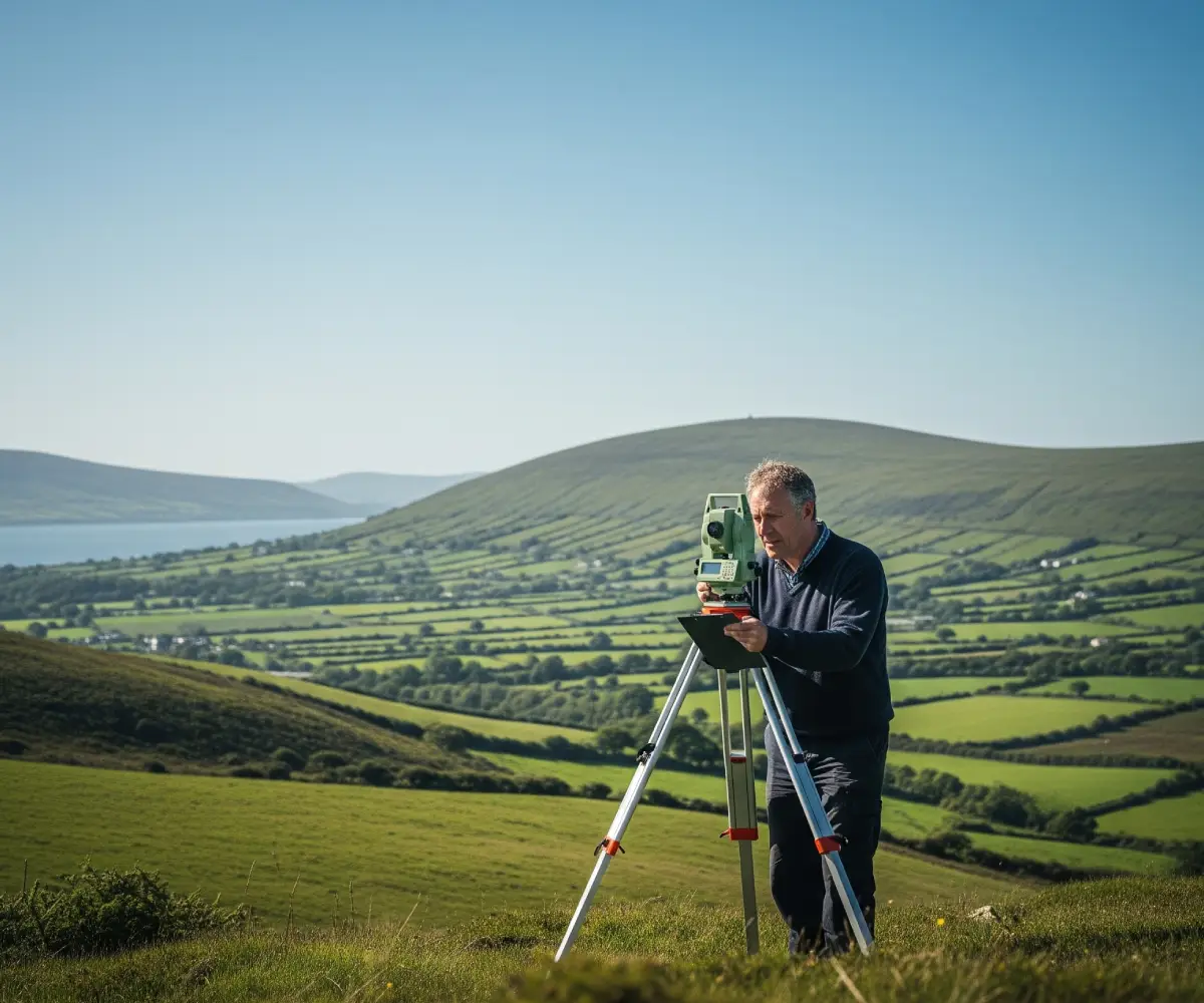
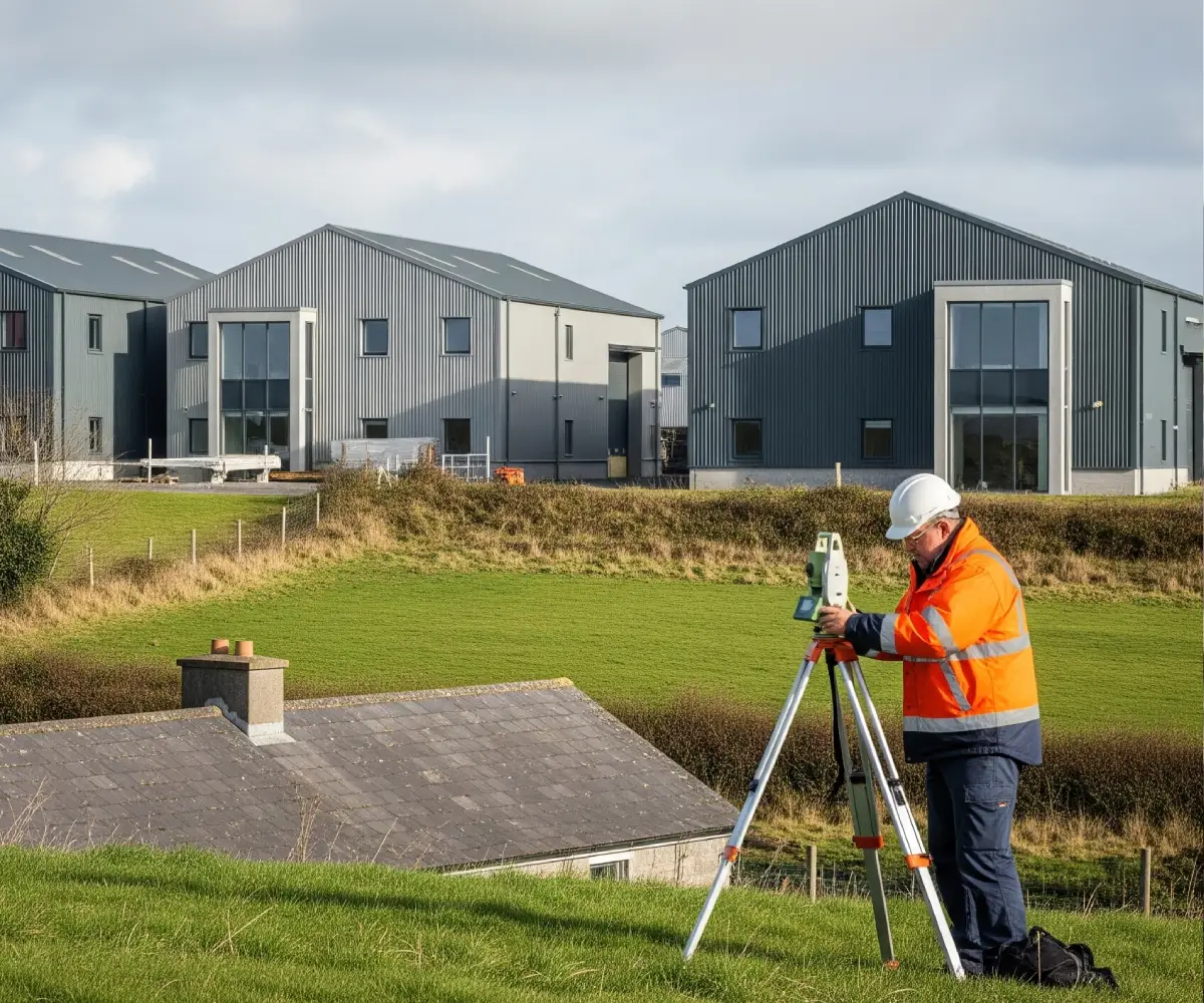
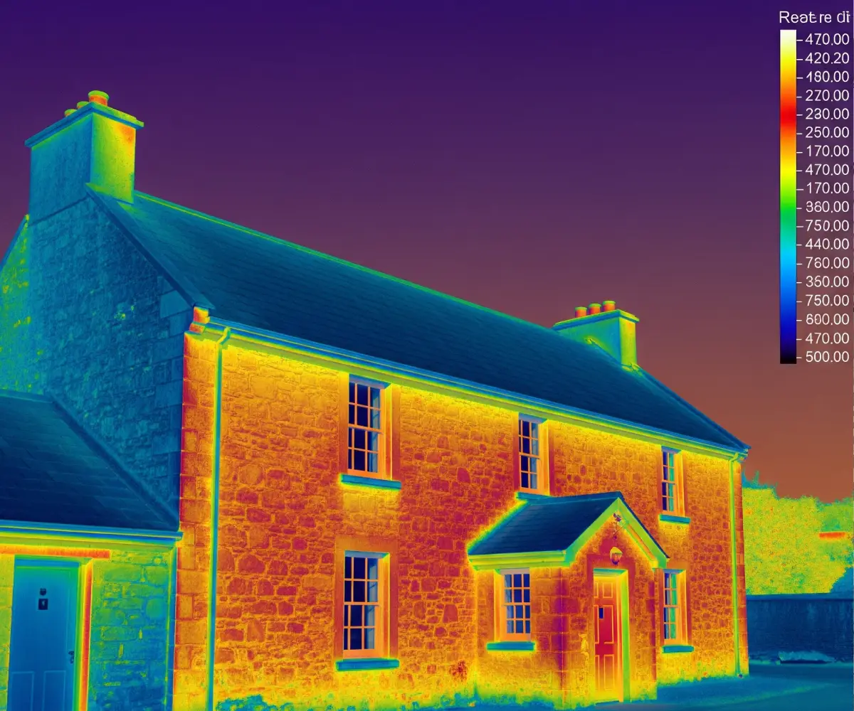
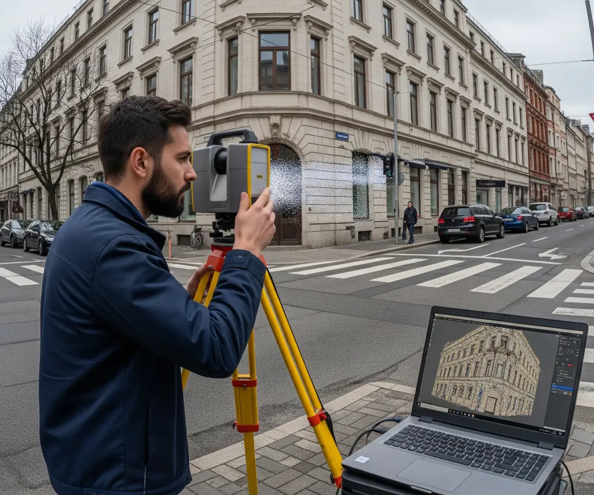
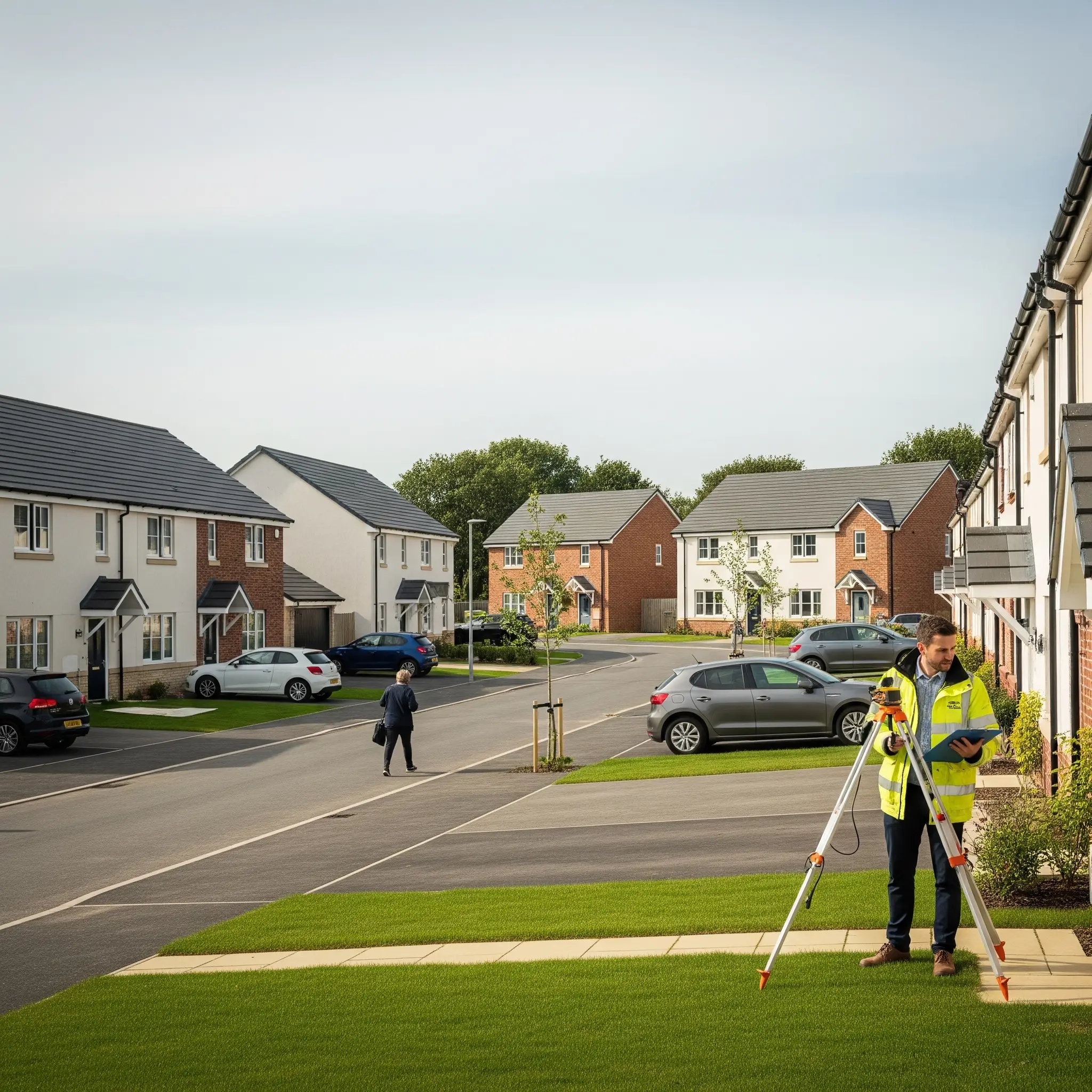
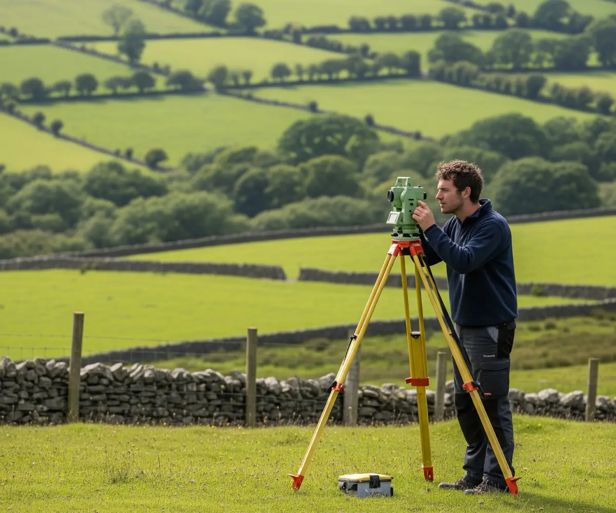
Our surveys include levels, contours, boundary lines, buildings, roads, trees, utilities, and other surface features specific to your site and project needs.

This depends on the site size and complexity, but most projects are completed within a few days, with results delivered shortly after.

Yes. A topographical survey is essential for design accuracy, planning applications, and ensuring construction is based on real-world site conditions.

Accurate & Detailed Mapping – Comprehensive data for informed design and planning.

Faster Decision-Making – Clear site data reduces risk and speeds up approvals.

Tailored Deliverables – CAD, PDF, or BIM formats suited to your team’s workflow.

Cost-Efficient & Scalable – Suitable for small plots to large developments.

Compliant with Irish Regulations – Surveys meet all local and legal standards

How It Works?

  1. Free Consultation
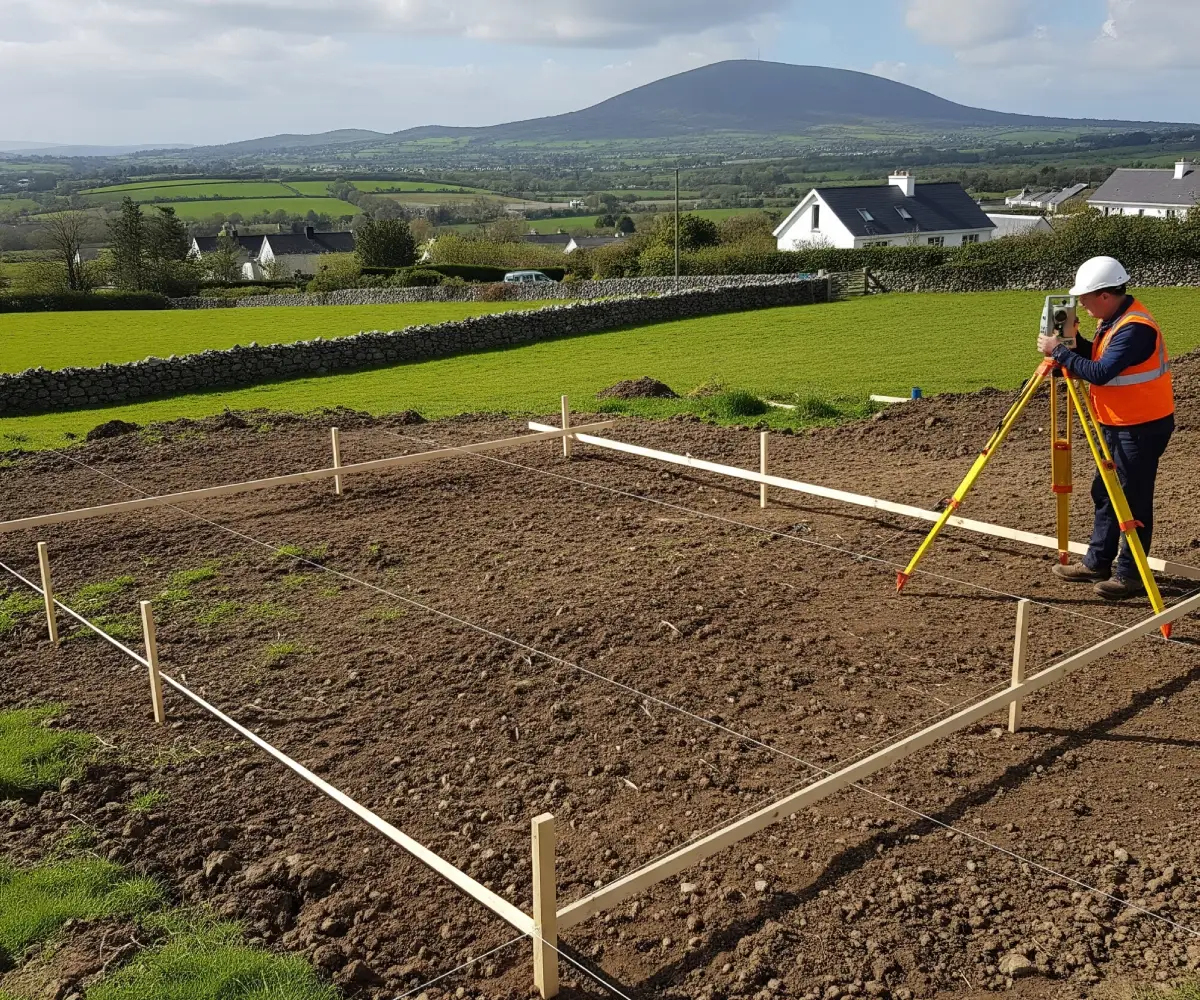
    We discuss your site, project goals, and what you need from the survey.
  2. On-Site Data Collection
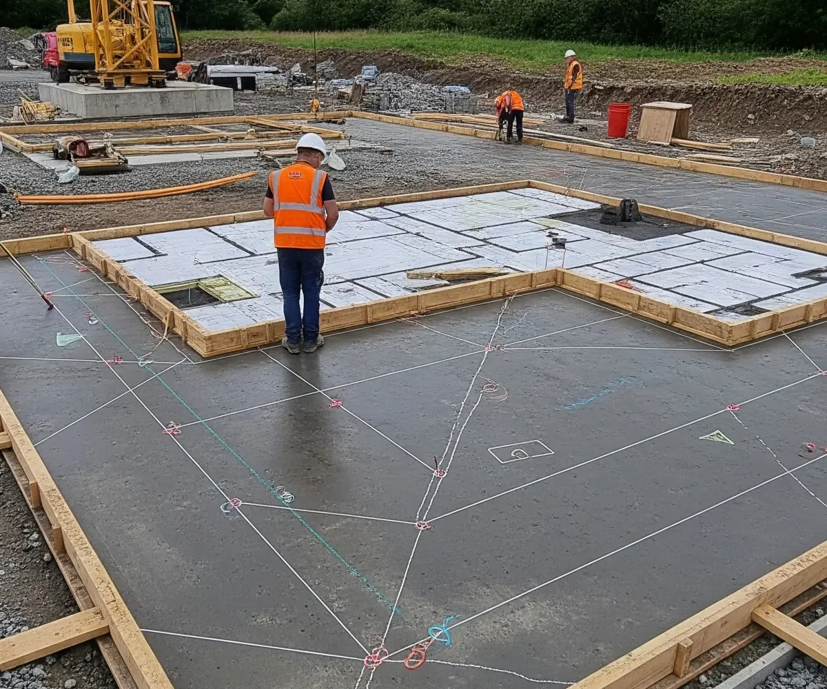
    Our team visits the site with advanced equipment to capture all relevant features.
  3. Data Processing & Drafting
    Survey data is processed and turned into detailed plans or 3D models using industry-standard software.
  4. Review & Delivery
    We send you the results in your preferred format, ready for immediate use in planning, design, or reporting.
Surveyor measuring

Service Overview

At GeoCityMark, we deliver precise Measured Building Surveys to provide a comprehensive and accurate picture of a building’s structure. From internal floor layouts to elevations, sections, and roof details, we capture all critical features to help you plan, design, or manage your property with confidence.

Project Planning

Accurate building data from the outset helps reduce costly design errors and streamlines the entire project process.

Satisfied Clients

Our clients value our responsiveness, precision, and the clarity of our deliverables.

Dedicated Team

Our experienced surveyors ensure that every project is delivered on time and to the highest standards.

FAQ

Depending on your needs, it can include floor plans, ceiling plans, internal/external elevations, sections, roof plans, and 3D models.

We use advanced tools like 3D laser scanners, total stations, and photogrammetry to capture accurate spatial data.

Yes. A detailed measured survey ensures that your design work aligns with the building’s actual structure, reducing errors and rework later.

High Accuracy & Detail – Essential for design, renovation, or redevelopment.

Custom Deliverables – Receive 2D CAD drawings, 3D BIM/Revit models, or other preferred formats.

Suitable for Any Building – From historic buildings to modern complexes.

Quick Turnaround – Fast and efficient data collection with minimal disruption.

Fully Compliant – All surveys follow Irish and industry best practices.

How It Works?

1. Initial Consultation
We assess your project and define the scope of survey work based on your requirements.

2. Site Survey
Our team conducts a detailed on-site scan, capturing all necessary structural and architectural features.

3. Processing & Drafting
Survey data is processed using industry-standard software to produce your requested deliverables.

4. Delivery & Review
Final drawings or models are sent in your preferred format. We also provide clarification or revisions if needed.

building boundaries measuring

Service Overview

At GeoCitymark, we provide precise Setting Out services that ensure construction projects are executed exactly as designed. By transferring key points from plans directly to the ground, we help builders position foundations, walls, drainage systems, and structural elements with absolute accuracy.

Project Planning

Key reference points and design elements are laid out accurately, helping prevent costly construction errors.

Satisfied Service

Our clients rely on us to bring precision and reliability to every stage of their construction.

Dedicated Team

Experienced surveyors work with advanced tools ensure each site is accurately prepared for build-out.

FAQ

Setting out translates design drawings into physical points on-site—marking where walls, roads, services, and other features should be built.

It should take place before construction begins and at key stages of the build, such as foundations, structural walls, and services layout.

Yes, we offer as-built surveys to confirm that the completed structures match the original setting out and design specifications

High-Precision Marking – Ensures accurate placement of foundations, walls, utilities, and structural elements.

Minimises On-Site Errors – Reduces rework and delays caused by inaccurate measurements.

Advanced Equipment – We use GPS and robotic total stations for speed, reliability, and pinpoint accuracy.

Customised Approach – Services tailored to suit each project’s scale and complexity.

Full Compliance – Aligns with Irish construction standards and engineering best practices.

How It Works?

1. Consultation & Review
We review your design drawings and site requirements to plan the setting out process.

2. On-Site Setup
Our team visits your site and marks key points according to your architectural or engineering plans.

3. Verification & Adjustment
We verify alignment, levels, and positions using real-time data and adjust as needed for full accuracy.

4. Optional As-Built Survey
Once construction is complete, we can conduct an as-built survey to validate the finished work.

Setting up

Service Overview

Our surveys accurately define property boundaries, easements, rights of way, and other legally significant features—helping you resolve disputes, complete transactions, and meet legal requirements with confidence. Using advanced equipment and methodologies like GPS, total stations, and digital mapping tools, we create precise, detailed maps tailored to the legal aspects of your project. Whether you’re preparing documents for the Property Registration Authority, resolving a boundary issue, or preparing for litigation, our maps are trusted, compliant, and professionally presented.

Project Planning

Clear boundary data ensures your property plans, developments, or legal filings are based on solid ground—literally.

Satisfied Service

From private landowners to legal firms, our clients value our precision, reliability, and professionalism.

Dedicated Team

Our experienced legal mapping surveyors are experts in both fieldwork and legal compliance, ready to guide you through complex projects.

FAQ

A legal map shows precise property boundaries, access routes, easements, and any relevant legal features affecting land ownership or usage.

Yes. We offer impartial, evidence-based mapping for dispute resolution, and can also provide expert witness services where required.

Absolutely. We provide PRA-compliant legal maps for registration, subdivision, and conveyancing purposes.

PRA-Compliant Maps – Fully accepted for registration and legal documentation
Dispute Resolution Support – Clear, accurate mapping to resolve or prevent boundary issues
Expert Witness Services – Professional documentation and representation when needed
Digital & Hard Copy Outputs – Delivered in your preferred format (PDF, CAD, GIS)
Fast Turnaround – Responsive service for urgent legal requirements
Trusted Across Ireland – Serving legal professionals, surveyors, and property owners nationwide

How It Works?

1. Free Consultation
We review your situation and advise on the best mapping solution—whether it’s a boundary check, dispute, or registration.

2. On-Site Surveying
Our licensed surveyors visit your site using high-precision GPS and total station equipment.

3. Data Processing & Drafting
We prepare detailed, legally accurate maps and documents to support your case or application.

4. Final Delivery
You receive your map in digital or physical format, ready to file, share, or present in legal proceedings.

img

Service Overview

Using the latest in terrestrial and mobile laser scanning technology, we create detailed 3D point clouds, digital models, and comprehensive site representations. These outputs help you visualize and understand complex environments, detect potential issues early, and support more informed design and planning decisions.

Project Planning

From pre-design to as-built verification, laser scanning reduces guesswork and improves precision at every phase.

Satisfied Service

Trusted by architects, engineers, contractors, and conservationists across Ireland for quality data and dependable service.

Dedicated Team

Our technicians are laser scanning experts with the tools and experience to handle even the most complex environments.

FAQ

Typical outputs include point clouds, 2D CAD drawings, 3D BIM models, and mesh files—customised to your workflow.

Scanning is usually completed in one day for smaller sites. Larger or more complex projects may require multiple visits. Turnaround depends on the level of detail and deliverables required.

Ultra-High Accuracy – Millimetre-precision data for critical design decisions
Comprehensive Outputs – From raw point clouds to fully modelled 3D environments
Time-Saving – Faster site capture and reduced need for revisits
Ideal for Complex Projects – Perfect for irregular shapes, large sites, and inaccessible areas
Heritage & Conservation Ready – Non-invasive scanning ideal for historic sites
Tailored Deliverables – Compatible with leading platforms (Revit, AutoCAD, IFC)

How It Works?

1. Free Consultation
We assess your site and define exactly what type of scanning and deliverables you need.

2. On-Site Laser Scanning
Using terrestrial or mobile laser scanners, we capture millions of data points with exceptional accuracy.

3. Data Processing & Modelling
Our team converts the scan data into usable 2D or 3D formats for your planning or design needs.

4. Delivery & Support
Receive your files in the format that works best for your team—along with ongoing support if needed.

Laser scanning

Service Overview

At GeoCityMark, we offer comprehensive BCAR (Building Control (Amendment) Regulations) Management services to ensure your project remains fully compliant with Irish building regulations from start to finish. Our BCAR services are designed to simplify the process, reduce risk, and support smooth project delivery across residential, commercial, and public sector developments.

Project Planning

Assigned Certifiers, Design Certifiers, and contractors to manage the full lifecycle of BCAR documentation and inspections.

Satisfied Service

We understand the importance of compliance, accountability, and detailed record-keeping under the BCAR.

Dedicated Team

Each project is managed with precision, tailored to your specific scope, timelines, and responsibilities.

Benefits of Service

BCAR (Building Control (Amendment) Regulations) ensure that buildings in Ireland are designed and constructed in compliance with Building Regulations. It’s a legal requirement for most building projects since 2014.

While the builder and the owner are ultimately responsible, the process is overseen by the Assigned Certifier who works with designers and contractors. Our role is to support that entire process with expertise and structure.

Yes. We handle the preparation and lodgement of required documents to the Building Control Management System (BCMS), ensuring a smooth and compliant workflow from design to Completion Certificate.

✅ Regulatory Compliance Made Easy
We ensure all BCAR requirements are fulfilled on time, reducing legal and financial risk.

✅ Streamlined Documentation
From design to completion, we manage and track all required forms and certificates via the BCMS.

✅ Support for Your Entire Team
We work alongside Assigned Certifiers, contractors, and designers for seamless project coordination.

✅ Digital Efficiency
Real-time tracking, digital audits, and cloud-based documentation ensure transparency and easy access.

✅ Faster Sign-Offs
With everything in order, Completion Certificates are submitted and approved with fewer delays.

How It Works?

1. Initial Consultation
We review your project to determine which BCAR requirements apply and outline the documentation needed for compliance.

2. Coordination with Project Team
We liaise with Assigned Certifiers, designers, and builders to assign roles, confirm responsibilities, and establish a workflow.

3. Document Preparation & Submission
Our team compiles and submits all necessary forms — including commencement notices, design certificates, and inspection plans — through the BCMS portal.

4. Ongoing Compliance Tracking
We monitor inspections, manage updates, and keep detailed records of each stage to ensure everything stays on track and compliant.

5. Completion & Certification
Once construction concludes, we assist in gathering completion documentation, final inspection records, and ensure timely submission of the Completion Certificate for approval.

BCAR Management