Service Overview
Project Planning
Satisfied Service
Dedicated Team
FAQ
Typical outputs include point clouds, 2D CAD drawings, 3D BIM models, and mesh files—customised to your workflow.
Scanning is usually completed in one day for smaller sites. Larger or more complex projects may require multiple visits. Turnaround depends on the level of detail and deliverables required.
✅ Ultra-High Accuracy – Millimetre-precision data for critical design decisions
✅ Comprehensive Outputs – From raw point clouds to fully modelled 3D environments
✅ Time-Saving – Faster site capture and reduced need for revisits
✅ Ideal for Complex Projects – Perfect for irregular shapes, large sites, and inaccessible areas
✅ Heritage & Conservation Ready – Non-invasive scanning ideal for historic sites
✅ Tailored Deliverables – Compatible with leading platforms (Revit, AutoCAD, IFC)
How It Works?
1. Free Consultation
We assess your site and define exactly what type of scanning and deliverables you need.
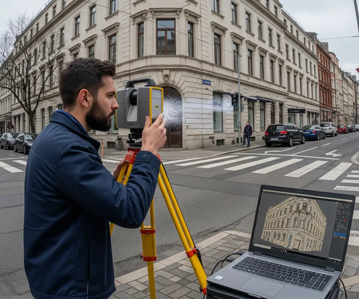
2. On-Site Laser Scanning
Using terrestrial or mobile laser scanners, we capture millions of data points with exceptional accuracy.
3. Data Processing & Modelling
Our team converts the scan data into usable 2D or 3D formats for your planning or design needs.
4. Delivery & Support
Receive your files in the format that works best for your team—along with ongoing support if needed.